Introduction
Introduction
Groundwater is prime natural resources in the earth .Not only it supported almost all types of life form to evolve, but also helped in growth of human civilization. It quenches thirst and meets the household demands. Used in the fields for production of food grains .Lastly the industries catering to the various needs and luxuries of human being have started consuming voluminous quantity of Water .Groundwater is therefore a precious national asset and planning, development and Management of water resources need to be governed by national perspectives.
In the beginning, water from rainfall and snow and rivers were only source of water to mankind. As these surface water sources were dependent on rainfall, localized shortage was often witnessed. With primitive technologies men was not able to build sustainable water reservoir to see them through the drought period .But once man came to know of groundwater, his dependence on it increased with the advent of civilization. At present about two billion people in the world is dependent on groundwater. Fortunately, groundwater is a renewable resource that is recharged every year through rainfall. However, this recharging process is not entirely dependent on rainfall but on various other natural factors that differ from region to region and within space and time. Therefore, recharge of groundwater is never a constant factor .When the average quantity of draft exceeds recharge for repeated years we face the situation of over exploitation.
The manner and the scale in which the use of groundwater has accelerated, human being has become so much dependent on the assured source that no sign of the over increasing demand for groundwater stabilizing.
Beginning of 20th century witnessed demand for groundwater in industrial sector rising phenomenally at a faster rate than that in agriculture and domestic sector.
West Bengal is the only state in India that stretches from Mountain to the Sea and truly a “Asamudra himachalam” state as the meaning goes. West Bengal has a very good groundwater potential. The reason of such affluence is due to her geographical location, high rainfall and favorable geological setting .The state have land area of about 2.7% but have about 6% of total replenishible groundwater resources of India. Groundwater is the most exploited resource in west Bengal particularly in agriculture sector With the introduction of water intensive high yielding variety , the need for groundwater have skyrocketed. Quinquennial census of minor irrigation structures indicated a 64% growth in number of STWs over last 16 years,@4% annually.
Table Showing Number of Groundwater Structures from 1986 to 2001
Name of Structure 1986-87 1994-95 2000-2001
Dug Well 63387 55983 39377
Shallow Tubewell 368316 504638 603667
Deep Tubewell 3122 4039 5139
Hydrogeological Condition
Geologically West Bengal can be divided into two broad units (A) Consolidated or semi consolidated formation occurring in the northern most and western part of West Bengal and (B) Unconsolidated formation in the rest of West Bengal.
(A) Consolidated/ semi consolidated formations:
These formations cover the western and the northern part of the state. These are comprised of Archaean crystalline rocks and Gondwana group of rocks including Rajmahal traps covering part of Purulia, Bankura Paschim Medinipur, Birbhum and Burdwan.. Archaean metamorphics, Siwalik and Gondwana covers part of Darjeeling and Jalpaiguri District. In the western part and in some part of Darjeeling district , these hard and semi consolidated rocks are overlain by weathered residuum and laterite capping.
(B) Unconsolidated formations:
These formations belonging to the Tertiary and Quaternary age and covering rest of West Bengal. These formations may be subdivided into (a) Secondary laterite (b) Older alluvium and (c) Recent alluvium.
Secondary laterite occurs at the marginal area between the Consolidated/ semi-consolidated rock and older alluvium mainly in the districts of Bankura, Paschim Medinipur, Burdwan and Birbhum. Older alluvium occurs mainly in the elevated terraces fringing the lateritic margin of the Chhotonagpur plateau in Bankura, Pascim Medinipur, Burdwan, Birbhum, Hoogli and Murshidabad district and in the Barind region of North Bengal. Recent sediments occupy the river courses and flood plains.
Depletion of groundwater
In spite of having high groundwater reserve, exploitation of the resources in West Bengal shot up to such level that 80’s decade first witnessed the sign of depletion of groundwater level in some blocks of Murshidabad, Burdwan, Medinipur, Hoogly where pre-monsoon water level dropped below the centrifugal pumping limit and hand tubewells went dry. Introduction of Submersible motor driven pump though came as a blessing to the cultivators, for it can draw water from far deeper depth – caused further lowering of groundwater level.
Depth to water level data analyzed by the State Water Investigation Directorate, Govt. of W. Bengal, indicated significant average annual fall in pre monsoon depth to water level during the period 1995 to 2004 to the tune of 16 to 70 centimeters in some blocks of Murshidabad, Burdwan, Purba Medinipur and Hoogly districts. In some parts of Hooghly, Burdwan and Murshidabad districts, significant fall was noticed in both pre and post monsoon period.
Case 1 No change
Case 2- Post monsoon no change but pre monsoon falling trend
Case 3 both pre & post monsoon show falling trend
Case 4: Pre monsoon rising trend, post monsoon falling.
Groundwater Quality
In addition to the phenomenon of lowering of water level, deterioration in Chemical quality of groundwater was noticed in some parts of the state that took place in the form of Arsenic and Fluoride contamination. On the basis of preliminary survey 81 blocks in the state have been identified where Arsenic was found in groundwater above permissible limit. Similarly, presence of Fluoride beyond permissible limit in groundwater was detected in 49 blocks of the State.
It was observed that the entire younger and recent alluvium formation east of Bhagirathi River is arsenic bearing and reason for such occurrence is solely Geogenic. Arsenic held by the solid phases within the sediments, especially iron oxides, organic matter and sulphides might constitute the primary arsenic sources in groundwater under condition condusive to arsenic release from solid phases.
Occurrence of Fluoride, in groundwater is generally recorded from hard rock areas. The subsurface water may be contaminated with dissolved substance due to disintegration and dissolution of bed rock that rendered water unfit for drinking due to presence of certain toxic constituents. Fluoride is one such chronic toxic substance, that have affected large number of people causing Skeletal or Dental fluorosis. Fluorite (CaF2), Cryolite (Na Al F6) is the rock forming minerals which contribute Fluoride to the groundwater. Wastewater containing Fluoride originating from various industries viz phosphate fertilizer, ceramic industry brick kiln and pharmaceutical industries may find its way to the groundwater and elevate the Fluoride level.
Assessment of Groundwater Resources
Apprehending phenomenal increase in extraction of Groundwater, Government of India considered that quantitative assessment of these resources is necessary for planning and sustainable development. Accordingly , Ministry of water Resources formed Groundwater Estimation Committee , which came out with a methodology based on reasonably valid scientific principles and reliable data .The first assessment of the resources was carried out in 1984. Meanwhile, Central Groundwater Board and different State Water investigation Organizations carried out further detailed studies and generated additional database which along with the ever-rising Groundwater utilization through the country, indicated need for modifying the methodology for more precise assessment. Another Estimation Committee was set up in 1995 came out with modified methodology in 1997 known as GEC ’97 methodology. Assessment of Groundwater resources of all the States were carried out jointly by the Central Groundwater Board and the respective State groundwater Organizations with block as unit and 2004 as base year.
The assessment revealed that the national average for stage of groundwater development is 58% whereas the same for the State of West Bengal is 42%.The assessed blocks were categorized, on the basis of stage of development and long term significant decline of groundwater level, as ‘Safe’, ‘Semi-Critical’, ‘Critical’ and ‘Over exploited’ .In the national scenario, 4078 blocks are Safe out of total 5723 blocks.
In West Bengal assessment was carried out in 269 blocks out of total 341 blocks leaving aside 13 hilly blocks in the north and 59 Saline blocks of coastal region. As per the assessment carried out by application of GEC’97 methodology, 231 blocks have been found to be Safe .28 blocks were assessed to be Semi-Critical and 10 blocks as Critical. However State committee on groundwater assessment is reviewing assessment and categorization of this 10block.
Based on the assessment carried out the net groundwater availability in West Bengal was calculated to be 27.46 BCM, whereas existing groundwater draft in all sectors –irrigation , domestic and industrial , is 11.65 BCM, leaving 15.81 BCM of dynamic resources reserve for further use.
Planned approach for Groundwater development
The groundwater scenario at national level and that of West Bengal reveal that exploitation of groundwater in the state has not yet reached alarming critical stage .The national water policy 2002 states that exploitation of groundwater should be limited to the extent of annual recharge. Although the average stage of groundwater development is 42% in the state , adverse effects like water level depletion and chemical degradation have been noticed in some areas in scattered manner. Government is concerned about incidents of suffering of the local population in such areas due to shortage of water in peak summer and from diseases due to consumption of arsenic and fluoride contaminated water.
It was apprehended that if indiscriminate use of water go on unabated, adverse effects of degrading hydrogeological regime of the state, will amplify and will engulf the whole state in such a manner that the whole agriculture and industrial development process will suffer a set back. The Government had determined view not to allow such situation and decided to promulgate suitable Act to control and regulate the use of groundwater in the State.
Groundwater Act
West Bengal Groundwater Resources (Management , Control & Regulation ) Act 2005 was promulgated with effect from 15th September ‘2005.This act stipulates obtaining mandatory permit for installation of groundwater extraction structures operated by engine or motor driven pump .This act also , stipulate registration of all such structures existed before the act came into force.
Apart from West Bengal, other states viz. Himachal Pradesh, Kerala, Goa and Tamil Nadu have already passed suitable acts for control and regulation of groundwater .Andra Pradesh had enacted Water , land and tree act in 2002. Maharashtra enacted groundwater (regulation for drinking water sources) Act in 1993 for limited purpose of regulating public drinking water. For the remaining states either the groundwater bill is under drafting or draft bill is under consideration of the respective government.
Conclusion
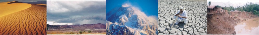
Crisis of Water is probably the worst curse any civilization would like to face. It will be tragic for the next generation facing this crisis due to lack of foresight in part of the present generation. The groundwater resources, although renewable, are limited and vulnerable. Crisis of water may not be only quantitative; quality degradation may also add a different dimension to the problem.
West Bengal, which is considered to have tremendous groundwater potentialities, is no exception. Crunch is already felt in drinking water sector in rural west Bengal during Boro cultivation season precipitating a situation of artificial draught in almost every year. Unpredictable monsoons, destruction of green coverage, siltation of rivers, uncontrolled urbanization have compounded this problem. Area under arsenic and fluoride are increasing day by day. Failures in part of the authority to implement the Groundwater Act and lack of awareness in part of the users have failed to check unrestricted growth of tubewells in the state. Stages of groundwater development with 2004 as base year that show a meager 42% stages of groundwater development in the state as against a national average of 58% , needs to be upgraded .The 4th Minor Irrigation Census is presently underway and results might reflect a higher Stages of groundwater development for this state. The act for controlling extraction of groundwater is probably not adequate in itself for total management of groundwater resources unless people is made to aware about the adverse situation which may arise from unplanned and indiscriminate use of groundwater. The other strategies involve co-ordinate approach to conservation, augmentation and conjunctive use of groundwater, wherever possible. This can be successfully achieved through rain water harvesting and artificial recharge that make it possible to:
1. Restore supply in aquifer, depleted due to overexploitation.
2. Improve chemical quality
3. Prevent salinity ingress.
4. Increase hydrostatic pressure against land subsidence
To implement rain water harvesting and artificial recharge to be implemented , it is necessary to adopt policy decisions like mandatory installation of roof top rain water harvesting and artificial recharge structures in urban areas and restoration of all derelict tanks in the villages , building check dams etc in high slope areas.
Groundwater is not an isolated resource. It is a phenomenon within the hydrological cycle. So depending on the hydrogeological condition, water level condition and stage of development proper measure for augmentation of groundwater should be taken.
Introduction
Groundwater is prime natural resources in the earth .Not only it supported almost all types of life form to evolve, but also helped in growth of human civilization. It quenches thirst and meets the household demands. Used in the fields for production of food grains .Lastly the industries catering to the various needs and luxuries of human being have started consuming voluminous quantity of Water .Groundwater is therefore a precious national asset and planning, development and Management of water resources need to be governed by national perspectives.
In the beginning, water from rainfall and snow and rivers were only source of water to mankind. As these surface water sources were dependent on rainfall, localized shortage was often witnessed. With primitive technologies men was not able to build sustainable water reservoir to see them through the drought period .But once man came to know of groundwater, his dependence on it increased with the advent of civilization. At present about two billion people in the world is dependent on groundwater. Fortunately, groundwater is a renewable resource that is recharged every year through rainfall. However, this recharging process is not entirely dependent on rainfall but on various other natural factors that differ from region to region and within space and time. Therefore, recharge of groundwater is never a constant factor .When the average quantity of draft exceeds recharge for repeated years we face the situation of over exploitation.
The manner and the scale in which the use of groundwater has accelerated, human being has become so much dependent on the assured source that no sign of the over increasing demand for groundwater stabilizing.
Beginning of 20th century witnessed demand for groundwater in industrial sector rising phenomenally at a faster rate than that in agriculture and domestic sector.
West Bengal is the only state in India that stretches from Mountain to the Sea and truly a “Asamudra himachalam” state as the meaning goes. West Bengal has a very good groundwater potential. The reason of such affluence is due to her geographical location, high rainfall and favorable geological setting .The state have land area of about 2.7% but have about 6% of total replenishible groundwater resources of India. Groundwater is the most exploited resource in west Bengal particularly in agriculture sector With the introduction of water intensive high yielding variety , the need for groundwater have skyrocketed. Quinquennial census of minor irrigation structures indicated a 64% growth in number of STWs over last 16 years,@4% annually.
Table Showing Number of Groundwater Structures from 1986 to 2001
Name of Structure 1986-87 1994-95 2000-2001
Dug Well 63387 55983 39377
Shallow Tubewell 368316 504638 603667
Deep Tubewell 3122 4039 5139
Hydrogeological Condition
Geologically West Bengal can be divided into two broad units (A) Consolidated or semi consolidated formation occurring in the northern most and western part of West Bengal and (B) Unconsolidated formation in the rest of West Bengal.
(A) Consolidated/ semi consolidated formations:
These formations cover the western and the northern part of the state. These are comprised of Archaean crystalline rocks and Gondwana group of rocks including Rajmahal traps covering part of Purulia, Bankura Paschim Medinipur, Birbhum and Burdwan.. Archaean metamorphics, Siwalik and Gondwana covers part of Darjeeling and Jalpaiguri District. In the western part and in some part of Darjeeling district , these hard and semi consolidated rocks are overlain by weathered residuum and laterite capping.
(B) Unconsolidated formations:
These formations belonging to the Tertiary and Quaternary age and covering rest of West Bengal. These formations may be subdivided into (a) Secondary laterite (b) Older alluvium and (c) Recent alluvium.
Secondary laterite occurs at the marginal area between the Consolidated/ semi-consolidated rock and older alluvium mainly in the districts of Bankura, Paschim Medinipur, Burdwan and Birbhum. Older alluvium occurs mainly in the elevated terraces fringing the lateritic margin of the Chhotonagpur plateau in Bankura, Pascim Medinipur, Burdwan, Birbhum, Hoogli and Murshidabad district and in the Barind region of North Bengal. Recent sediments occupy the river courses and flood plains.
Depletion of groundwater
In spite of having high groundwater reserve, exploitation of the resources in West Bengal shot up to such level that 80’s decade first witnessed the sign of depletion of groundwater level in some blocks of Murshidabad, Burdwan, Medinipur, Hoogly where pre-monsoon water level dropped below the centrifugal pumping limit and hand tubewells went dry. Introduction of Submersible motor driven pump though came as a blessing to the cultivators, for it can draw water from far deeper depth – caused further lowering of groundwater level.
Depth to water level data analyzed by the State Water Investigation Directorate, Govt. of W. Bengal, indicated significant average annual fall in pre monsoon depth to water level during the period 1995 to 2004 to the tune of 16 to 70 centimeters in some blocks of Murshidabad, Burdwan, Purba Medinipur and Hoogly districts. In some parts of Hooghly, Burdwan and Murshidabad districts, significant fall was noticed in both pre and post monsoon period.
Case 1 No change
Case 2- Post monsoon no change but pre monsoon falling trend
Case 3 both pre & post monsoon show falling trend
Case 4: Pre monsoon rising trend, post monsoon falling.
Groundwater Quality
In addition to the phenomenon of lowering of water level, deterioration in Chemical quality of groundwater was noticed in some parts of the state that took place in the form of Arsenic and Fluoride contamination. On the basis of preliminary survey 81 blocks in the state have been identified where Arsenic was found in groundwater above permissible limit. Similarly, presence of Fluoride beyond permissible limit in groundwater was detected in 49 blocks of the State.
It was observed that the entire younger and recent alluvium formation east of Bhagirathi River is arsenic bearing and reason for such occurrence is solely Geogenic. Arsenic held by the solid phases within the sediments, especially iron oxides, organic matter and sulphides might constitute the primary arsenic sources in groundwater under condition condusive to arsenic release from solid phases.
Occurrence of Fluoride, in groundwater is generally recorded from hard rock areas. The subsurface water may be contaminated with dissolved substance due to disintegration and dissolution of bed rock that rendered water unfit for drinking due to presence of certain toxic constituents. Fluoride is one such chronic toxic substance, that have affected large number of people causing Skeletal or Dental fluorosis. Fluorite (CaF2), Cryolite (Na Al F6) is the rock forming minerals which contribute Fluoride to the groundwater. Wastewater containing Fluoride originating from various industries viz phosphate fertilizer, ceramic industry brick kiln and pharmaceutical industries may find its way to the groundwater and elevate the Fluoride level.
Assessment of Groundwater Resources
Apprehending phenomenal increase in extraction of Groundwater, Government of India considered that quantitative assessment of these resources is necessary for planning and sustainable development. Accordingly , Ministry of water Resources formed Groundwater Estimation Committee , which came out with a methodology based on reasonably valid scientific principles and reliable data .The first assessment of the resources was carried out in 1984. Meanwhile, Central Groundwater Board and different State Water investigation Organizations carried out further detailed studies and generated additional database which along with the ever-rising Groundwater utilization through the country, indicated need for modifying the methodology for more precise assessment. Another Estimation Committee was set up in 1995 came out with modified methodology in 1997 known as GEC ’97 methodology. Assessment of Groundwater resources of all the States were carried out jointly by the Central Groundwater Board and the respective State groundwater Organizations with block as unit and 2004 as base year.
The assessment revealed that the national average for stage of groundwater development is 58% whereas the same for the State of West Bengal is 42%.The assessed blocks were categorized, on the basis of stage of development and long term significant decline of groundwater level, as ‘Safe’, ‘Semi-Critical’, ‘Critical’ and ‘Over exploited’ .In the national scenario, 4078 blocks are Safe out of total 5723 blocks.
In West Bengal assessment was carried out in 269 blocks out of total 341 blocks leaving aside 13 hilly blocks in the north and 59 Saline blocks of coastal region. As per the assessment carried out by application of GEC’97 methodology, 231 blocks have been found to be Safe .28 blocks were assessed to be Semi-Critical and 10 blocks as Critical. However State committee on groundwater assessment is reviewing assessment and categorization of this 10block.
Based on the assessment carried out the net groundwater availability in West Bengal was calculated to be 27.46 BCM, whereas existing groundwater draft in all sectors –irrigation , domestic and industrial , is 11.65 BCM, leaving 15.81 BCM of dynamic resources reserve for further use.
Planned approach for Groundwater development
The groundwater scenario at national level and that of West Bengal reveal that exploitation of groundwater in the state has not yet reached alarming critical stage .The national water policy 2002 states that exploitation of groundwater should be limited to the extent of annual recharge. Although the average stage of groundwater development is 42% in the state , adverse effects like water level depletion and chemical degradation have been noticed in some areas in scattered manner. Government is concerned about incidents of suffering of the local population in such areas due to shortage of water in peak summer and from diseases due to consumption of arsenic and fluoride contaminated water.
It was apprehended that if indiscriminate use of water go on unabated, adverse effects of degrading hydrogeological regime of the state, will amplify and will engulf the whole state in such a manner that the whole agriculture and industrial development process will suffer a set back. The Government had determined view not to allow such situation and decided to promulgate suitable Act to control and regulate the use of groundwater in the State.
Groundwater Act
West Bengal Groundwater Resources (Management , Control & Regulation ) Act 2005 was promulgated with effect from 15th September ‘2005.This act stipulates obtaining mandatory permit for installation of groundwater extraction structures operated by engine or motor driven pump .This act also , stipulate registration of all such structures existed before the act came into force.
Apart from West Bengal, other states viz. Himachal Pradesh, Kerala, Goa and Tamil Nadu have already passed suitable acts for control and regulation of groundwater .Andra Pradesh had enacted Water , land and tree act in 2002. Maharashtra enacted groundwater (regulation for drinking water sources) Act in 1993 for limited purpose of regulating public drinking water. For the remaining states either the groundwater bill is under drafting or draft bill is under consideration of the respective government.
Conclusion
Crisis of Water is probably the worst curse any civilization would like to face. It will be tragic for the next generation facing this crisis due to lack of foresight in part of the present generation. The groundwater resources, although renewable, are limited and vulnerable. Crisis of water may not be only quantitative; quality degradation may also add a different dimension to the problem.
West Bengal, which is considered to have tremendous groundwater potentialities, is no exception. Crunch is already felt in drinking water sector in rural west Bengal during Boro cultivation season precipitating a situation of artificial draught in almost every year. Unpredictable monsoons, destruction of green coverage, siltation of rivers, uncontrolled urbanization have compounded this problem. Area under arsenic and fluoride are increasing day by day. Failures in part of the authority to implement the Groundwater Act and lack of awareness in part of the users have failed to check unrestricted growth of tubewells in the state. Stages of groundwater development with 2004 as base year that show a meager 42% stages of groundwater development in the state as against a national average of 58% , needs to be upgraded .The 4th Minor Irrigation Census is presently underway and results might reflect a higher Stages of groundwater development for this state. The act for controlling extraction of groundwater is probably not adequate in itself for total management of groundwater resources unless people is made to aware about the adverse situation which may arise from unplanned and indiscriminate use of groundwater. The other strategies involve co-ordinate approach to conservation, augmentation and conjunctive use of groundwater, wherever possible. This can be successfully achieved through rain water harvesting and artificial recharge that make it possible to:
1. Restore supply in aquifer, depleted due to overexploitation.
2. Improve chemical quality
3. Prevent salinity ingress.
4. Increase hydrostatic pressure against land subsidence
To implement rain water harvesting and artificial recharge to be implemented , it is necessary to adopt policy decisions like mandatory installation of roof top rain water harvesting and artificial recharge structures in urban areas and restoration of all derelict tanks in the villages , building check dams etc in high slope areas.
Groundwater is not an isolated resource. It is a phenomenon within the hydrological cycle. So depending on the hydrogeological condition, water level condition and stage of development proper measure for augmentation of groundwater should be taken.
Groundwater is normally replenished at the bottom of lakes. If the lake bed is silted over, the replenishment cannot occur. Most of the silt in the water comes from aquatic weeds, such as water hyacinth or Typha. We must weed and dredge the rivers and lakes, and that will restore groundwater and the "lake effect" rains that we need again so desperately.
ReplyDeleteGround water is the water on which all of us more or less depending beacausr of it's importance. we all should properly managed the resours
ReplyDeleteGroundwater is replenished only where there is a permeable stratum at the ground surface. Groundwater recharge can occur on hills, flat lands, riverbeds and at all places from where water can percolate down to the aquifer.
ReplyDeleteThanks for sharing about ground water scenario have a look at
ReplyDeleteTanker Lorry Water Suppliers in Chennai
Lorry Water Supply in Chennai
Private Lorry Water Supply in Chennai