Thursday, June 21, 2012

Vaccine for drought: The 'rain god' of Saurashtra, Gujarat - Shri Premjibhai Patel of Vruksh Prem Seva Trust


Submitted by Yashodhar Dixit on May 17, 2012 - 13:00

Author : Yashodhar Dixit
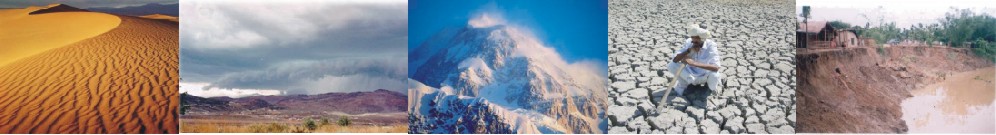
Saurashtra region of Gujarat state was cursed due to constant drought since many decades. But, not any more. It is due to mammoth efforts made by one man Shri Premjibhai Patel of Vruksh Prem Seva Trust.
Even as a businessman, he was constantly worried about depleting water availability in his birth state. He started planting trees 3 decades ago and with his innovative machine he planted  10 million trees and brought about climate change to the region. His next endeavour was to construct small check dams. Till date 2000 check dams are constructed and that bagged National Award by The Ministry of Water Resources in 2008. Dr. Kalam was so impressed with his work that he personally called him to meet when he was in Gujarat in 2010. He also praised him during "Young Innovators Award" in IIM Ahmedabad.
Shri Premjibhai's work has successfully controlled drought, stopped migration of people from the region, farmers have started taking more than 2 crops per annum, ecology has shown tremendeous change, drinking water problem was dealt with, water table has improvised and endless small and big creatures survived. The skill to take local people's help in work has given him upper edge in social work. Socio economic change was observed and many students studied his pattern of work.
Prof.Anil Gupta of IIM Ahmedabad has written: "Why can't we have a chapter in the text book about Premjibhai or his miraculous work?"
Right now Vruksh Prem is busy with rain water harvesting and so far constructed 1500 underground water tanks in the coastal region of Mangrol district of Gujarat. The prosperity of the Saurashtra region can be easily seen due to availability of essential commodity like water.
Times of India quotes him as "Rain God". The NGO is open in sharing his innovative methodology to any one and welcomes everyone to see the miracle.
For further details you may contact Shri Yashodhar Dixit on yashodhardixit@yahoo.com or 09898995664.
Name of Author: 
Yashodhar Dixit

Saturday, June 2, 2012

Hydrogeology of Rajarhat New Town


Geology
The project area and its surrounding parts are underlain by huge thickness of quaternary sediments laid down by the southerly flowing Bhagirathi river and its tributaries. The major area is occupied by recent alluvium comprising of gray sticky clay, fine and medium sand mainly. At a depth of 120 metre or more there is a brown clay horizon of sub recent age. Average thickness of the clay layer near to the surface is about 25 metres.
Hydrogeology:
Groundwater occurs in several granular zones deposited by the river system. Sand horizons of different grades textures and colours constitute the main aquifers. In Rajarhat area due to the presence of thick clay at the top the upper aquifer gives a semi confined character. The drilling data available from the tube well drilled at Ecospace, Bengal Ambuja Complex shows that there is a thick gray clay bed upto a depth of 10 metres. From 10 to 42 metres there are several layers of fine sand often mixed with clay. This is the upper low yielding aquifer of the area. Below this there is a dark gray clay bed between 42 metre and 55 metres.  From 55 metres to 84 metres there is a bed of fine sand. Below this medium sand occurs  upto a depth of 100 metres (16m thickness). Below this upto a depth of  135metres there is fine sand.
The litho log and assembly is given in plate I
The zone between 55 metre and 135 metre constitutes a potential aquifer in this area and most of the groundwater is withdrawn from this area.
GROUNDWATER LEVEL
Groundwater level in Rajarhat block is regularly monitored. The post monsoon Groundwater level (2011) of 7 monitoring stations in and around the project area is given in the table1. With the help of the data a depth to water level zonation map is prepared which is shown in plate II.

Table 1. Post Monsoon depth to water level of Rajarhat area. (Source: SWID)
Sl NoMouza
Location
Type of well
Post monsoon DWL mbgl
1              Patharghata      
Village centre
Tube well
5.5
2              Chandpur           
Panchayet office
Tube well
0.85
3              Gopalpur            
Health Centre
Tube well
11.25
4              Rajarhat              
Bishnupur Health Adm unit
Tube well
5.53
5              Ghuni   
Primary School
Tube well
9.9
6              Jagadishpur       
Primary School
Tube well
7.7
7              Sukantanagar Salt Lake 
Near Club
Tube well
12.3


It appears that the post monsoon depth to water level of the project area is between 8 to 9 metres below ground level. Water level is also collected from a deep tube well of the Tinkanya project site. The depth to water level of that well on25 January 2012 is 8.29 mbgl. The tube well tapped the aquifer between the depth 80m bgl to 95 m bgl.